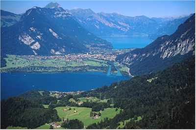
Interlaken is situated at the base of the Jungfrau Mountains between Lake Brienz and Lake Thun.
Lake Thun's approximately 2,500 square kilometer large catchment area frequently causes local flooding after heavy rainfall. This occurs because the river Aar, which drains the lake Thun, has only limited capacity to handle the excess runoff. The lake is fed by water from Lake Brienz to the southeast, which lies 6 meters higher than Lake Thun, and various streams int he Oberland, including the Kander. Lake Thun was created after the last ice age andw as originally part of Lake Brienz. The historic combined lake is called Wendelsee by geologists and historians.
Fishing os important enough to keep a handful of professional fishers employed. Since 1835, passenger ships have also operated on the lake. There are ten passenger ships in total, operated by the local railway company.
Following WWII and up till 1964, the Swiss Government disposed of unused munitions into Lake Thun. The quality of munitions dumped is reported to be from 3,000 to more than 9,020 tons.


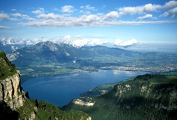
Lake Brienz took its name from the village of Brienz on its northern shore. The shores are steep, and there is almost no shallow water in the entire lake.
Lake Brienz is the first river in which the river Aar expands. When it leaves Lake Brienz, it soon joins Lake Thun. The lake lies in a deep hollow between the village of Brienz on the east and Bonigen on the west. Its length is about 14 kilometers, its width 2.8 kilometers, and its maximum depth 260 meters. On the south shore are the Giessbach Falls and the hamlet of Iseltwald. On the north shore are a few small villages.
The character of the lake is gloomy and sad as compared with its neighbour, that of Thun. It is poor in nutrients, and consequently fishing is not very important. Like Thun, passenger ships are also operated on this lake.
No comments:
Post a Comment